Saratoga Quarterly City Communications Drill
2021-05-15 10:00 – 11:30 (likely 1 hour)
PDF copy of this page: here
Net Control will be monitoring the SARA repeaters on 146.655 MHz, minus offset, PL of 114.8 Hz or on our linked 70cm repeater at 443.150 MHz, positive offset, PL 100 Hz.
The objectives of this drill include:
- Effective Communications
- Getting to know our community
- Getting to know one another
We have crafted this drill to focus on a number of fun activities to represent a windshield infrastructure survey. As you know, we might be asked to offer a Mike-Mike report indicating our earthquake intensity at each of our residences. Beyond that, we might be called upon to assist CERT teams, perform windshield surveys of areas of interest for the city, and help out in the early stages of learning (and communicating to city leadership) the health of the city.
To that end, this is a mobile event where ham radio operators will drive around Saratoga to locate and decide the health of various infrastructure sites. This might include readiness of several remote sewage pumping stations within Saratoga. In an actual emergency, these stations may need servicing thus ham radio operators could be very useful in reporting their status and acquiring assistance.
The objective is to locate the sites, inspect the equipment, and report their status back to Net Control. There will be questions to answer at each location. There will be a Red/White Poster at each with the answers. Please start with the site closest to your home location then tackle the remainder in whatever order you choose.
You have two choices:
- Stay home and follow along with the ‘Stay at home’ activities.
- Travel approximately 15 miles around Saratoga and follow the ‘Site Visit’ activities
Note: Some of the stations are up in the hills on windy roads.
Steps to follow:
- Before leaving home, check-into the net. Indicate if you will visit the locations or remain at home.
- Visit each location and perform the requested communications
- Check-out of the net.
- Please be prepared to respond to each health and welfare check. If you are not comfortable answering while actively driving, that is ok. Call in a health and welfare check as soon as you are in a safe place to do so.
SITE VISIT ACTIVITY #1 – Joe’s Trail
Directions:
Head north on Saratoga-Sunnyvale Rd. from Cox (towards Prospect). Right before the railroad tracks, turn right into the asphalt driveway and parking lot for Joe’s trail.
Site importance:
There are three hazards at this location:
- 230kV double overhead transmission line
- Large Valley Water pipeline to Cupertino from their Rinconada Treatment plant.
- Railroad tracks
Activity:
- Use the number people seen around you and call in to net control with an ‘informal message’. If there is an odd number of people, report no issues found. If there is an even number of people, report an issue: lines down, tracks look uneven, flooding in the area.
- Subject: Saratoga-Sunnyvale / Railroad tracks observations
- Body: something you craft on the fly
References:
Power Transmission: https://cecgis-caenergy.opendata.arcgis.com/app/ad8323410d9b47c1b1a9f751d62fe495
SITE VISIT ACTIVITY #2 – Valley Water Pumping Station (Big Basin Way at Fourth Street)
Directions:
Head southwest on Big Basin Way from the Saratoga fire station (toward uptown).
Proceed to the stop sign at fourth street.
The pumping station is a white stucco building directly ahead on the right.
There may be parking available farther up on Big Basin Way.
Site importance:
Activity:
Walk to the building and report if you can hear the sound of a pump running or not. Otherwise report that you saw the building and proceed on to the next activity.
SITE VISIT ACTIVITY #3 – Valley Water Pumping Station (Congress Springs Road at Tollgate Road)
Directions:
From the stop sign on Big Basin Way at fourth street, continue ahead on Big Basin Way about ¾ mile to Tollgate Road. You will pass Springer on the right, Hakone Gardens on the left, Ambric Knolls Road on the right and then a very well marked 20 mph curve. Tollgate Road and then the pumping station will soon be on your right (don’t turn onto Tollgate, just keep going a few more feet). At that point, Big Basin Way changes to Congress Springs Road.
The pumping station is just beyond Tollgate Road, on the righthand side. There is room to pull off of the road.
Site importance:
Activity:
Report whether you hear a pump running or not.
Use extreme care getting back on the road. There will likely be traffic, including motorcycles and bicycles, from both directions.
SITE VISIT ACTIVITY #4 – Wildcat Creek Flooding (Between Saratoga City Offices and Saratoga Library)
Directions:
Proceed to the Saratoga City Offices. Observe the creek level as it flows between the city offices and the Library. The best place to park would be the parking lot of the Warner Hutton House – site of the combined SARA/CERT picnic about 3 years ago.
The creek runs right behind the Warner Hutton house – between it and the Heritage Orchard.
Site importance:
Activity:
Observed the level of the water flows in the creek.
- If no water is observed, report “No Water.”
- If water is flowing, but only a few inches deep, report “No Flooding”.
- If water is more than a foot deep (estimate, don’t measure!), report “Flooding on Wildcat Creek”.
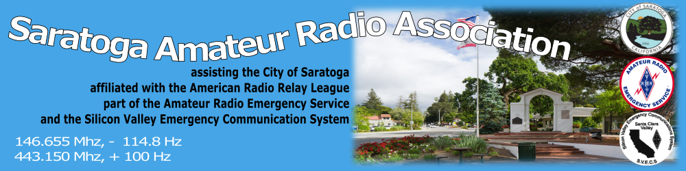
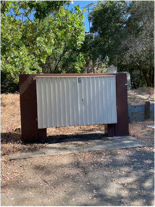
SITE VISIT ACTIVITY #4 – Cupertino Sanitary District Remote Pumping Station #1 PROSPECT
Directions:
On Corner of Saratoga-Sunnyvale & Prospect Road (on sidewalk, south-east corner)
(Park around back behind the nearby school)
Site importance:
Activity:
Question #1 Is there a Generator nearby? Yes ___ No ___
Question #2 What is the Holding Capacity? ___ Hours
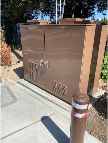
SITE VISIT ACTIVITY #5 – Cupertino Sanitary District Remote Pumping Station #2 KIRKBROOK
Directions:
On Corner (East side) of Kirkbrook Drive and Merida Drive
From Saratoga-Sunnyvale / Prospect, head East on Prospect. Turn right on Covina Ct. Turn left on Kirkbrook. System should be in front of you within three houses.
Site importance:
Sewage from a number of blocks gravity flows to here. This pump is needed to send the effluent to the Prospect station.
Activity:
Question #1 Is there a Generator nearby? Yes ___ No ___
Question #2 What is the Holding Capacity? ___ Hours
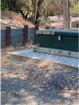
SITE VISIT ACTIVITY #6 – Cupertino Sanitary District Remote Pumping Station #3 VIA REGINA
Directions:
From Saratoga-Sunnyvale road, head West on Pierce Rd. Turn right on Via Regina. Within ¼ mile, near Pike Rd.
Site importance:
Sewage from a number of blocks gravity flows to here. This pump is needed to send the effluent to a location where gravity can be used to send it futher along.
Activity:
Question #1 Is there a Generator nearby? Yes ___ No ___
Question #2 What is the Holding Capacity? ___ Hours
SITE VISIT ACTIVITY #7 – Cupertino Sanitary District Remote Pumping Station #4 VISTA REGINA (not VIA REGINA)
Directions:
From Saratoga-Sunnyvale road, head West on Pierce Rd. Once you pass Via Regina, the next street should be Vista Regina. Turn right on Vista Regina. 200 feet north of the intersection, you should locate the pumping station.
Site importance:
Sewage from a number of blocks gravity flows to here. This pump is needed to send the effluent to a location where gravity can be used to send it futher along.
Activity:
Question #1 Is there a Generator nearby? Yes ___ No ___
Question #2 What is the Holding Capacity? ___ Hours
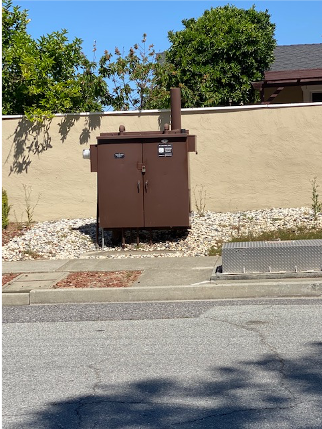
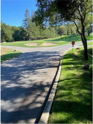
SITE VISIT ACTIVITY #8 – Valley Water Pump and Generator – SARATOGA COUNTRY CLUB
Directions:
Enter the Saratoga Country Club and turn left on an asphalt road almost immediately after entering the property Within 100 yards down the asphalt driveway, you should locate the equipment.
Site importance:
Needed to move water from the storage tank to nearby properties.
Activity:
Question #1 Is there a Generator nearby? Yes ___ No ___
Question #2 What is the Holding Capacity? ___ Hours
HOME ACTIVITY #1 – Valley Water Flood Map
Directions:
Go to the Valley Water webs site: https://www.valleywater.org/
Go to the map in the front page and zoom into the map on the lower part of that first page. Zoom in near where Quito road crosses Highway 85. Click on that intersection to activate the map details. You might need to click on the “X” in a searched location pop-up to clear it.
Call Net Control and report you are ready to report on streams. You will be asked a question that will be answered on that map.
Activity:
Report in an answer to something you learned such as:
- How many Surface Monitoring stations are on the map? They show like little radio towers.
- What is the name of the creek flowing through the left-most station?
- What is the name of the creek flowing through the right-most station?
- What creek flows through West Valley College?
HOME ACTIVITY #2 – FEMA Flood Map
Directions:
Go to the FEMA flood web site: https://www.floodsmart.gov/flood-map-zone/find-yours
About halfway down the page, click on the link for “Flood Map Service Center.”
Activity:
Report in an answer to something you learned such as:
- The flood risk at your house.
- The highest flood risk within Saratoga.
HOME ACTIVITY #3 – Drought Map for California
Directions:
Go to the FEMA flood web site: https://www.floodsmart.gov/flood-map-zone/find-yours
About halfway down the page, click on the link for “Flood Map Service Center.”
Activity:
Report in an answer to something you learned such as:
- The flood risk at your house.
- The highest flood risk within Saratoga.
HOME ACTIVITY #4 – Reservoir Gage Information
Directions:
Go to the Valley Water Reservoir Gage Information: https://alertold.valleywater.org/rgi.php
Activity:
Report in an answer to something you learned such as:
- The total reservoir level system-wide.
- The reservoir level of one reservoir (you choose).
- Why is Anderson Reservoir at the dead pool level (water level below the discharge pipes)?
HOME ACTIVITY #5 – National 7-Day Significant Fire Potential
Directions:
Go to the National Interagency Coordination Center of the National Interagency Fire Center: https://fsapps.nwcg.gov/psp/npsg/forecast#/outlooks?state=forecast&gaccId=4&gaccId=4
We are in the California North Ops, in a predictive Service Area titled NC03B – Diablo-Santa Cruz Mtns
Activity:
Report in an answer to something you learned such as:
- What is the highest risk in our area for the next 7 days
- Are there any concerns listed in the weather briefing?
HOME ACTIVITY #6 – PG&E PSPS Potential
Directions:
Go to the PG&E PSPS Portal at: https://www.pge.com/en_US/safety/emergency-preparedness/natural-disaster/wildfires/psps-weather-map.page
We are in portions of Zones 3, 4, and 7.
Activity:
Report in an answer to something you learned such as:
- Are there and PSPS watches shown for the next 7 days?
HOME ACTIVITY #7 – U.S. Drought Monitor
Directions:
Go to the US Drought Monitor at: https://droughtmonitor.unl.edu/CurrentMap/StateDroughtMonitor.aspx?CA
Note: Page might take 30-45 seconds to load.
Activity:
Report in an answer to something you learned such as:
- What is the drought intensity for parts of Santa Clara County?
- About what percentage of the state is in D3?
- Where is the nearest D2 (Severe Drought) area to us?
Forms
- Blank Forms